

The use of satellite imagery has played a significant part in the events currently taking place in Ukraine. Military satellite imagery earlier this week has been able to showcase further destruction caused by Russian armaments.
On Monday 6 June, 2022, high-resolution satellite images captured building damage caused by shelling and military explosions in Severdonetsk in the Donbas’s Luhansk region – the largest city in Ukraine that is still under their control.
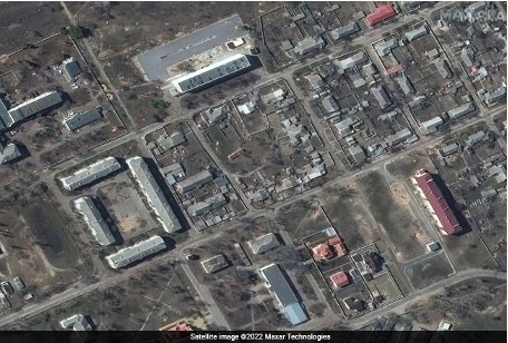
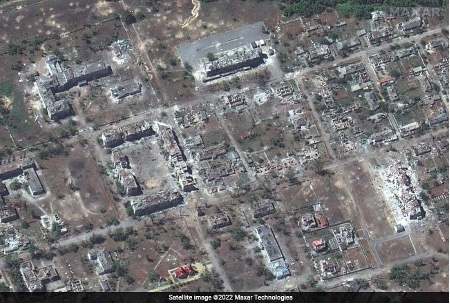
The images below demonstrate satellite pictures of the same area just 24 hours apart.
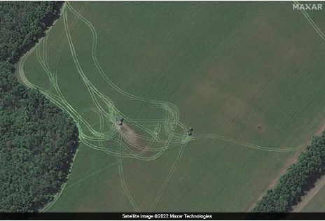
The images were able to identify the military destruction being caused by Multiple Rocket Launches – or MRLs – to execute these attacks as seen below.
70% of Ukraine is under Russian control, however, Ukraine is still finding back and satellite images such as those shown in this news article play a major role in boosting the operational capabilities of the nation's armed forces.


